
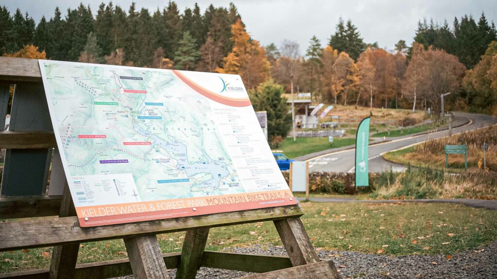
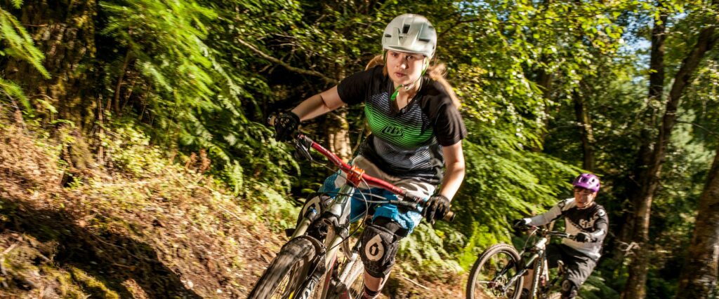
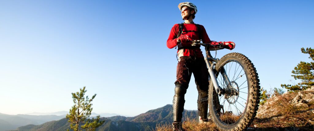
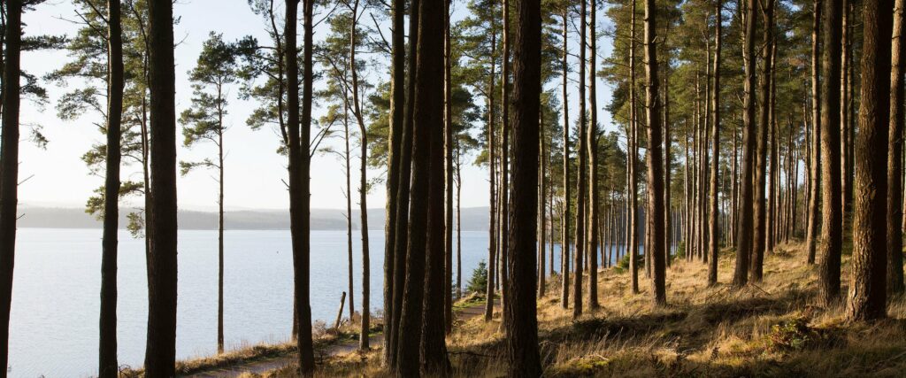
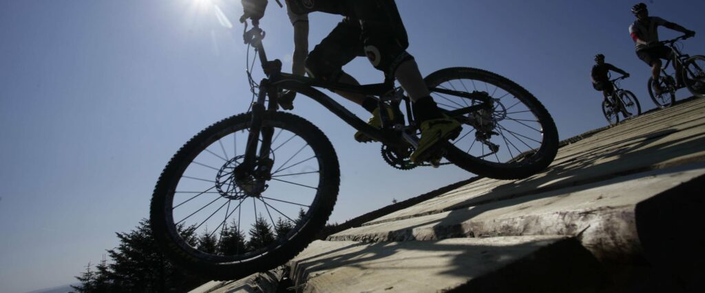
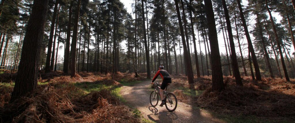
Kielder Forest is a true paradise for mountain bikers and gravel riders, offering a vast network of trails that wind through stunning landscapes, remote wilderness, and historical sites. Whether you’re looking for a challenging endurance ride or a scenic family-friendly route, there’s something for everyone. Plus, if you need a bike, you can hire one from our shop to get started on your adventure [BOOK HERE]. With thanks to Reiver Trails and Forestry England, here’s a breakdown of some of the best routes in and around Kielder Forest, complete with downloadable GPX files and PDF Maps for easy navigation.
Let’s start off with routes starting from the hub of Kielder Forest. These routes take in some of the best scenery Kielder Forest has to offer and they all start in the same place!
Bloody Bush Trail
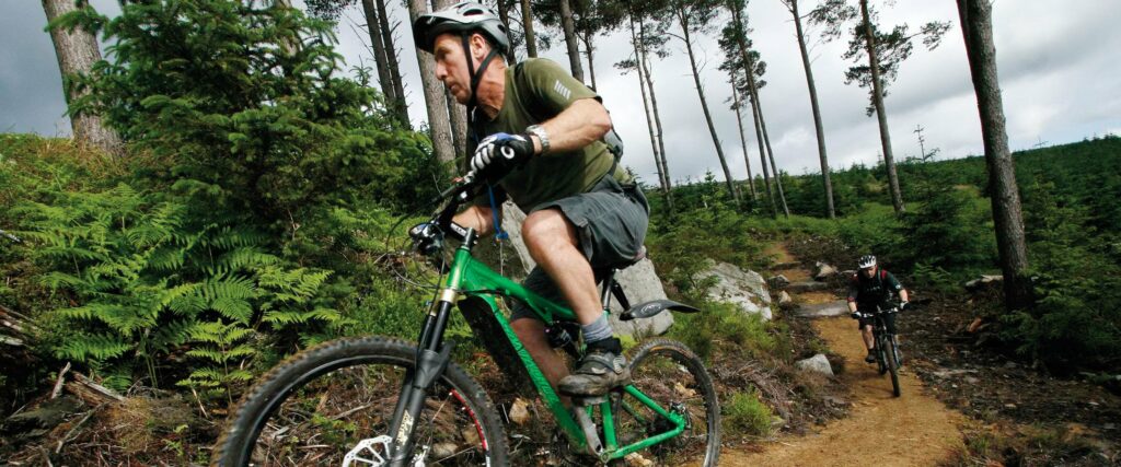
This impressive 33 km red-grade route combines both the Lonesome Pine and Bloody Bush MTB trails, offering a thrilling singletrack ride all the way to the border, where it connects with existing routes in Scotland. Perfect for experienced riders looking for an exciting challenge.
- Grade: Red
- Difficulty: Suitable for proficient mountain bikers with good off-roading skills.
- Trail Length: 20 miles (32 km)
- Download PDF Route Map
Borderline Cycle Trail
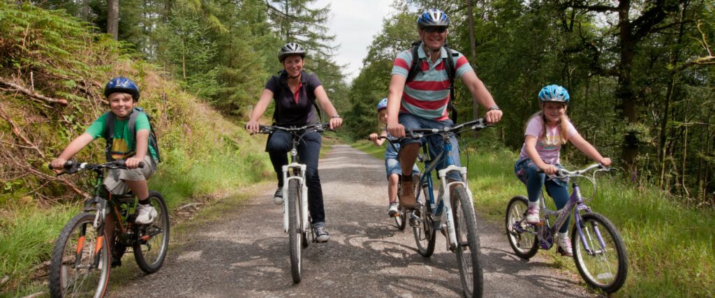
Following the former Border Counties railway line, which was operational from 1862 to 1956, this green-grade trail offers a relatively flat and easy ride. Ideal for families and cyclists of all abilities looking for a relaxed journey through history.
- Grade: Green
- Difficulty: Suitable for beginners or novice cyclists.
- Trail Length: 30 miles (48 km)
- Download PDF Route Map
Cross Border Cycle Trail
This long-distance route connects the Kielder trail network with the renowned 7 Stanes centre at Newcastleton in Scotland, offering a varied and scenic ride through forest roads.
- Grade: Forest Road
- Difficulty: Suitable for a wide range of cyclists.
- Trail Length: 30 miles (48 km)
- Download PDF Route Map
Deadwater Red Mountain Bike Trail
Take on the challenge of climbing Deadwater Fell to its 1,900 ft summit, which straddles the border and offers breathtaking 360-degree views from coast to coast. The thrilling descent back to Kielder Castle features specially constructed singletrack packed with exciting features.
- Grade: Red
- Difficulty: Suitable for proficient mountain bikers with good off-roading skills.
- Trail Length: 6.5 miles (10.5 km)
- Download PDF Route Map
Deadwater Up and Over Mountain Bike Trail
For expert riders seeking a technical challenge, this black-grade trail takes you up the 1,900 ft summit of Deadwater Fell before plunging back down via steep and demanding terrain. Expect adrenaline-pumping descents and breathtaking scenery.
- Grade: Black
- Difficulty: Suitable for expert mountain bike users, used to physically demanding routes.
- Trail Length: 10.5 miles (17.5 km)
- Download PDF Route Map
Lakeside Way Trail
A stunning multi-user path that winds around Kielder Water, offering access to some of the most scenic parts of the lake and the chance to encounter local wildlife. This trail is shared with walkers, horse riders, and forest vehicles, so please be mindful of other users.
- Grade: Blue
- Difficulty: Suitable for intermediate cyclists or mountain bikers with basic off-road riding skills.
- Trail Length: 26 miles (42 km)
- No Map Currently Available
Lonesome Pine Trail
Starting on the Lakeside Way, this route ascends to the summit of Purdom Pike, standing over 1,000 feet high. The panoramic views of the North Tyne Valley are nothing short of spectacular. The trail features a unique 1,000-yard timber fly-over to help riders navigate the boggy terrain.
- Grade: Red
- Difficulty: Suitable for proficient mountain bikers with good off-roading skills.
- Trail Length: 11 miles (18 km)
- Download PDF Route Map
Osprey Mountain Bike Trail
Starting at Kielder Castle, this blue-grade trail follows the Forest Drive before leading riders through sweeping singletrack sections alongside Kielder Burn. It finishes at the Lakeside Way, where riders can visit the stunning Sylvan Capitalis ‘Forest Head’ sculpture.
- Grade: Blue
- Difficulty: Suitable for intermediate cyclists or mountain bikers with basic off-road riding skills.
- Trail Length: 12 miles (19 km)
- Download PDF Route Map
Bellingham Trail
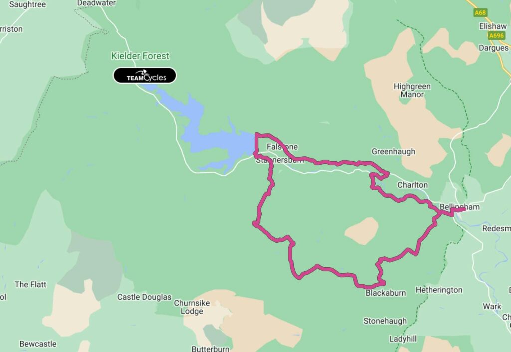
This scenic loop takes you through the North Tyne Valley, offering breathtaking views across Bellingham and beyond. With undulating terrain, this trail provides an enjoyable and accessible ride for cyclists of all levels. You’ll cross Kielder Dam and pass through Falstone Village, an excellent place for a mid-ride coffee stop at Falstone Tea Rooms.
- Length: 50.02 km (31.08 miles)
- Difficulty: Easy
- Estimated Cycling Time: 3 hrs
- Download GPX File
Cross Crags Trail
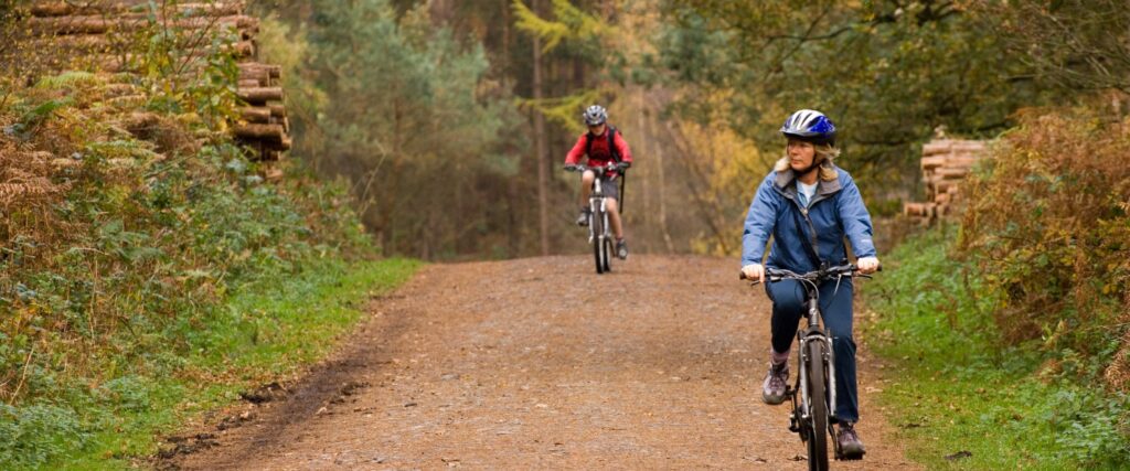
For those seeking a more challenging ride, the Cross Crags Trail takes you deep into the heart of Kielder Forest. The route includes some tough climbs but rewards you with breathtaking panoramic views. You’ll also have the chance to visit the centrally located memorial cairn dedicated to Lord Robinson, the man behind Kielder Forest. Be prepared, as this route shares forest roads with timber lorries, adding to the adventure.
- Length: 47.48 km (29.50 miles)
- Difficulty: Hard
- Estimated Cycling Time: 4 hrs
- Download GPX File
Bull Crag Trail
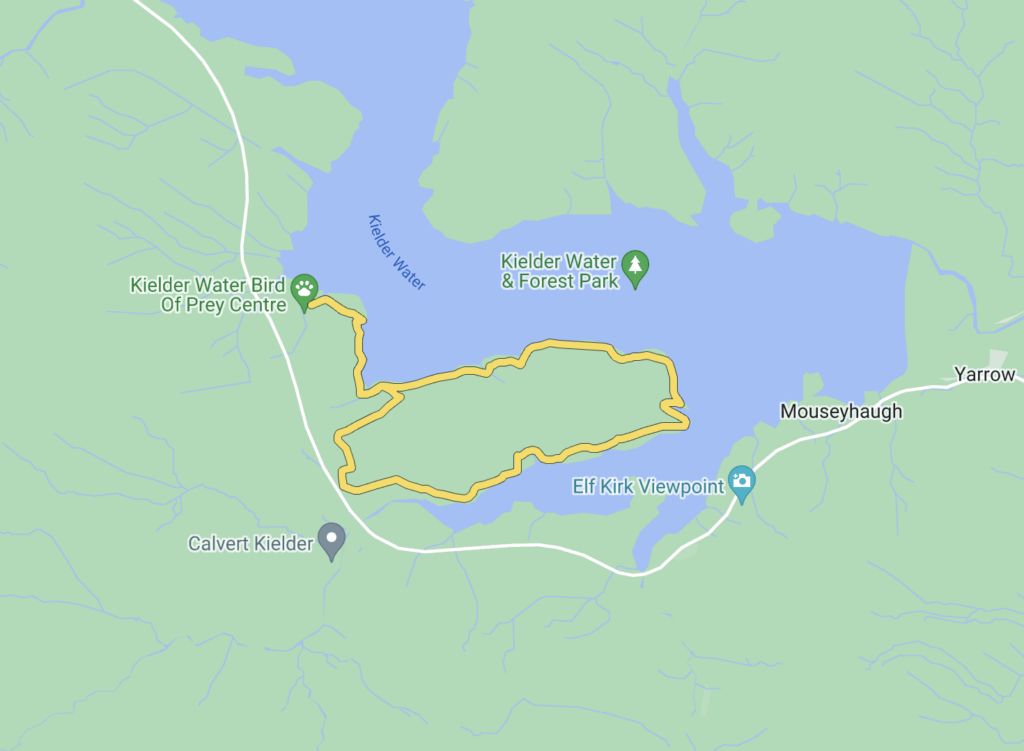
Ideal for families and beginners, this short and enjoyable loop offers stunning views of Kielder Water. Highlights include a visit to Freya’s Cabin, an artistic wooden shelter forming part of Kielder’s art and architecture trail. The ride finishes back at Kielder Waterside, where you can grab a well-deserved meal at The Boat Inn.
- Length: 10.14 km (6.30 miles)
- Difficulty: Easy
- Estimated Cycling Time: 30 mins
- Download GPX File
Crossborder Trail
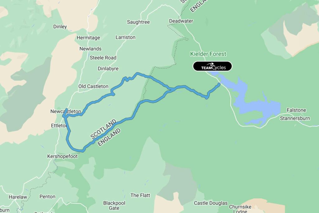
This epic trail connects Kielder Forest with Newcastleton in Scotland, following historic Reiver routes and remote valleys. The ride is physically demanding, featuring long climbs and fast descents, but it’s well worth it for the stunning landscapes and the opportunity to grab a meal in Newcastleton before the return journey.
- Length: 46.68 km (29.01 miles)
- Difficulty: Hard
- Estimated Cycling Time: 2.5 hrs
- Download GPX File
Emblehope Trail
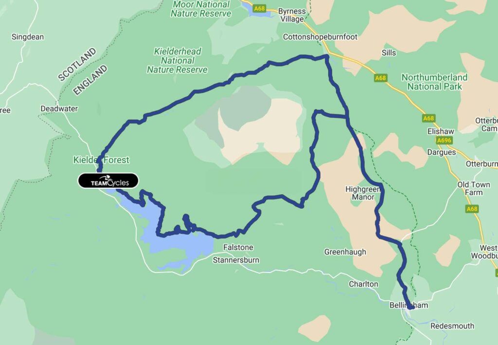
A true endurance challenge, this long-distance ride showcases the wild landscapes of Redesdale and the North Tyne Valley. Riders are rewarded with breathtaking views and a mix of gravel roads and quiet lanes. This route is not waymarked, so be sure to download the GPX file before setting off.
- Length: 92.86 km (57.70 miles)
- Difficulty: Hard
- Estimated Cycling Time: 5 hrs
- Download GPX File
Falstone Trail
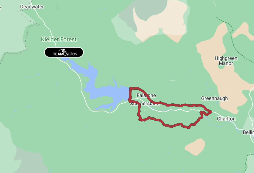
This moderate loop is a great way to experience the beauty of Kielder Water and the surrounding valleys. Featuring steady climbs and thrilling descents, this route provides spectacular views of the North Tyne. Be sure to stop at the café or the Blackcock Inn in Falstone for refreshments.
- Length: 24.30 km (15.10 miles)
- Difficulty: Easy
- Estimated Cycling Time: 2 hrs
- Download GPX File
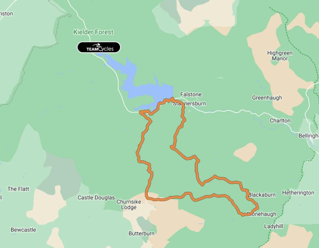
Stonehaugh Trail
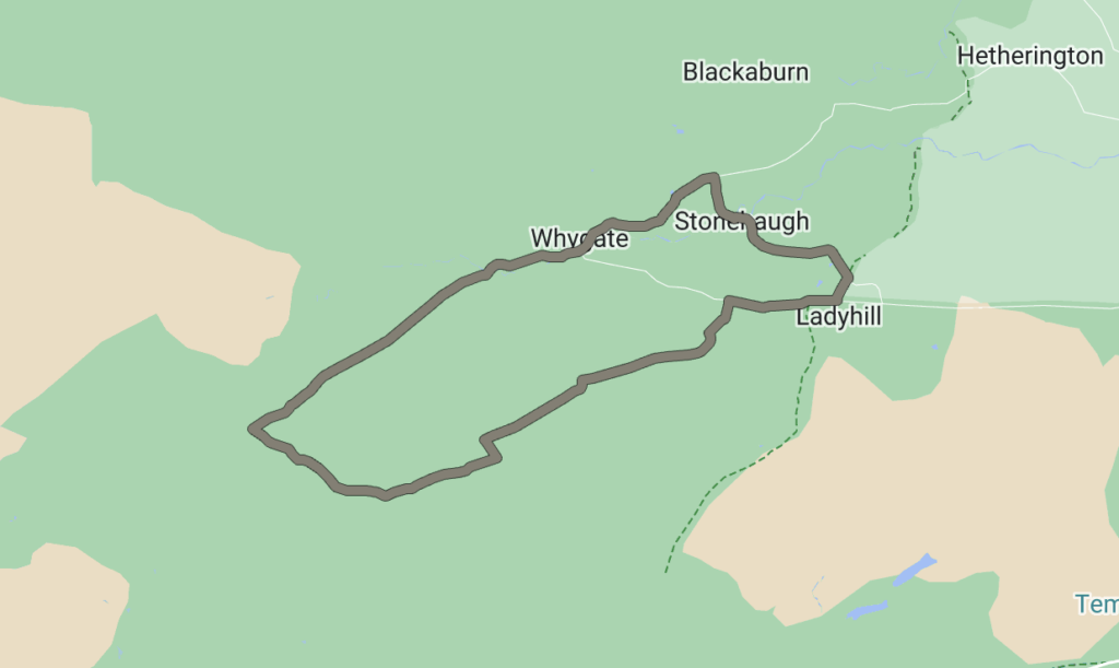
Set on the southern edge of Kielder Forest, this intermediate route offers a mix of forest tracks and quiet roads, making it perfect for those new to off-road riding. The village of Stonehaugh provides a great place to rest and refuel.
- Length: 18.02 km (11.20 miles)
- Difficulty: Medium
- Estimated Cycling Time: 1.15 hrs
- Download GPX File
The Sill Circular
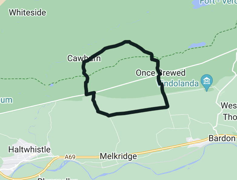
This short and scenic loop near Hadrian’s Wall is perfect for a leisurely ride. It follows ancient byways and quiet lanes, offering fantastic views of the South Tyne Valley. Stop at The Sill National Landscape Discovery Centre for a coffee and explore more about the history of the area.
- Length: 9.82 km (6.10 miles)
- Difficulty: Easy
- Estimated Cycling Time: 1 hr
- Download GPX File
Wark Forest Trail
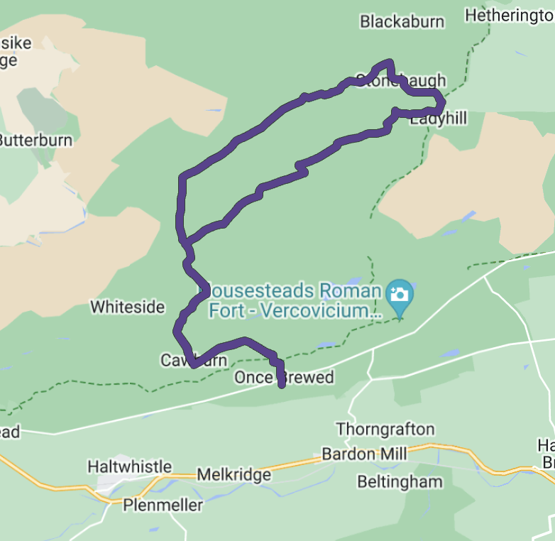
Connecting The Sill and Stonehaugh, this adventurous loop takes riders into the depths of Wark Forest. Expect some steep climbs and rewarding descents, with stunning views towards the Solway Firth on clear days. A great option for those looking to push their limits.
- Length: 39.27 km (24.40 miles)
- Difficulty: Medium
- Estimated Cycling Time: 3 hrs
- Download GPX File
Plan Your Kielder Adventure
Kielder Forest is a haven for mountain bikers and gravel riders of all abilities. Whether you’re tackling one of the challenging long-distance routes or enjoying a relaxed ride along the lakeside, there’s no shortage of incredible trails to explore.
Don’t forget to download the GPX files, pack your essentials, and prepare for an unforgettable ride in one of the UK’s most stunning cycling destinations!


